Living in Thurston, Springfield, Oregon
Thurston is an east Springfield neighborhood in ZIP code 97478 — not a separate city. It follows the Highway 126 and Thurston Road corridors, with shopping, schools, parks, and a short drive east toward the McKenzie River.
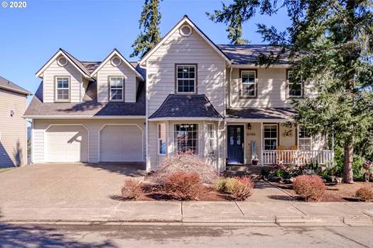
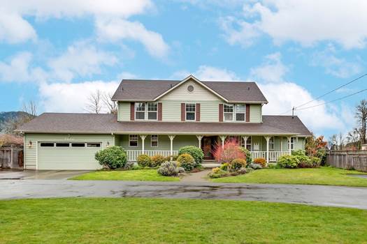
Streets range from established cul-de-sacs to newer subdivisions and homes near the wooded foothills. Lot size, traffic, and distance to the highway can change from one pocket to the next, so compare specific parts of Thurston rather than treating the whole area as one market. Browse the Springfield homes for sale search above, then reach out when you want to walk a property.
Parks and trails
Lively Park on Thurston Road has a large playground, picnic shelters, courts, walking paths, a community garden, and dog areas. Next to it is Splash! at Lively Park , an indoor waterpark with a wave pool, slide, and swim lessons.
Thurston Hills Natural Area sits on the east edge of Springfield, with miles of hiking and mountain-bike trails. Thurston Park is the smaller neighborhood park — grass, play equipment, a basketball court, and paths that connect toward Thurston High School.
Schools in Thurston, Springfield
Homes in the area are often served by Thurston Elementary, Ridgeview Elementary, Thurston Middle School, and Thurston High School. Schools follow the address and can change, so check the property in the Springfield Public Schools boundary lookup before you make an offer.
How Thurston, Springfield Got Its Name
Thurston started as a crossroads near today's Thurston Road and 66th Street — a store, a blacksmith, and a stop on the road east. It was named for pioneer George H. Thurston. A post office opened in 1877, long before the area became part of Springfield.
The first land claims here go back to 1851, and the settlement grew up along what is now High Banks Road, a stagecoach route running east along the McKenzie. For most of its life Thurston was not part of any city, until Springfield grew out to take it in. In 1960 the Springfield School District opened the new Thurston High School on 58th Street.
That date explains the streets. Most of the housing went up after the annexation rather than before it, which is why a neighborhood with an 1877 post office is mostly made of homes from the last fifty years.
Working With a Local Springfield Agent
Heart & Home Real Estate is a local Lane County brokerage. Our agents can walk you through what is active, what is pending, and what a street feels like in person — including how the highway sounds from the yard, which changes a lot from one pocket to the next out here.
Questions people ask about Thurston, Springfield
- Is Thurston part of Springfield or its own town?
- It is a Springfield neighborhood now, but it used to be its own place. Thurston was an unincorporated community with its own post office — opened in 1877 — until Springfield annexed it. That is why people still talk about it the way they would talk about a town, and why the name sticks to the schools.
- When were most Thurston homes built?
- Mostly after the annexation. Roughly half the housing here went up between 1976 and 1994, with another large share between 1995 and 2009 — the middle of the range sits around 1980. You will find older places closer to the original crossroads and newer subdivisions out toward the foothills.
- What schools serve Thurston?
- Usually Thurston Elementary or Ridgeview Elementary, then Thurston Middle School and Thurston High School, all in Springfield Public Schools. Schools follow the address and the boundaries get redrawn, so check the specific home before you count on it.
- How close is Thurston to the McKenzie River?
- Close. The Highway 126 freeway ends at Main Street here, and the road continues east as the McKenzie River Scenic Byway. Thurston is the last neighborhood before the valley opens into the McKenzie corridor, which is why it has been called the gateway to the McKenzie for well over a century.